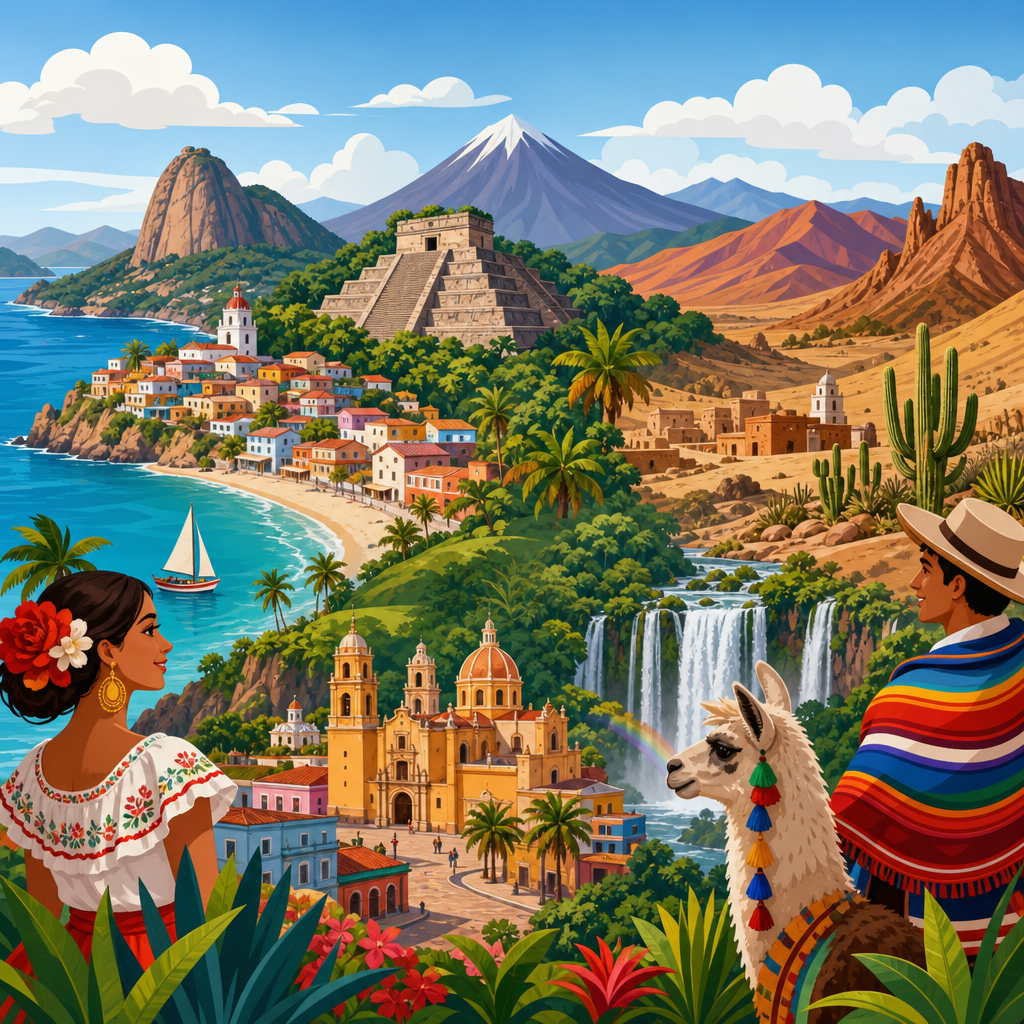
Spanish-speaking countries stretch across Europe, the Americas, Africa, and the Caribbean, creating one of the world’s most varied cultural and geographic networks. When people hear “Spanish-speaking world,” they often think first of Spain or Mexico, yet the term covers more than twenty sovereign states, each with distinct ecosystems, histories, accents, and social traditions. In travel writing, education, and community resources, this diversity is often flattened into a single stereotype. That is a mistake. The landscapes of Spanish-speaking countries range from Andean peaks and Amazonian rainforest to Atlantic islands, high deserts, cloud forests, coral coasts, fertile plains, and volcanic archipelagos.
Understanding these landscapes matters for anyone interested in Spanish community and interaction because geography shapes how people live, speak, eat, work, and connect. I have seen this repeatedly while building language and cultural content: a learner who understands why life in Bolivia’s altiplano differs from life on Cuba’s coast or in Uruguay’s grasslands gains a more practical, human view of Spanish than vocabulary lists alone can provide. Landscape influences migration routes, agriculture, architecture, transportation, tourism, and even local expressions. It also explains why the same language can sound and feel so different from one country to another.
This hub article provides a broad, organized overview of the diverse landscapes of Spanish-speaking countries and why they are central to cultural understanding. It defines the major regional patterns, highlights representative countries, and points readers toward related subtopics they can explore in more detail. Rather than treating Spanish-speaking countries as a uniform block, this guide presents them as a connected set of places shaped by climate, elevation, geology, and human settlement. If you want a solid starting point for the miscellaneous branch of Spanish community and interaction, this is the right foundation.
Mountain worlds, high plateaus, and volcanic regions
Some of the most dramatic landscapes in the Spanish-speaking world are defined by elevation. The Andes dominate western South America, shaping countries such as Colombia, Ecuador, Peru, Bolivia, Chile, and Argentina. These mountains affect everything from road design to crop selection. In Peru, for example, communities separated by valleys and peaks developed strong regional identities, and the country’s geography helps explain the difference between coastal Lima, highland Cusco, and the Amazonian east. In Bolivia, the altiplano creates a cold, high plain where daily life, construction, and agriculture differ sharply from tropical lowland areas like Santa Cruz.
Volcanic terrain also plays a defining role in several countries. Ecuador’s Avenue of the Volcanoes is one of the clearest examples, with peaks such as Cotopaxi and Chimborazo shaping national identity and tourism. Guatemala and El Salvador likewise sit in geologically active zones, where volcanoes have enriched soils for coffee cultivation but also created natural hazards. Spain’s Canary Islands, while politically part of Europe, add another volcanic dimension to the Spanish-speaking landscape, with black sand beaches, lava fields, and subtropical microclimates. These regions show how geology can support farming and biodiversity while also demanding long-term resilience planning.
Highland and volcanic landscapes tend to produce distinct settlement patterns. Cities often cluster in valleys or elevated basins where temperatures are milder than in nearby lowlands. Bogotá, Quito, and Mexico City all reflect this pattern, though each has unique environmental pressures. Mexico City, built in a high basin, faces air quality and water management challenges tied directly to topography and urban growth. For language learners and cultural observers, these mountain environments are not background scenery; they are active forces shaping regional development, infrastructure, and everyday interaction.
Tropical forests, river basins, and biodiversity hotspots
Rainforests and river systems define another major set of Spanish-speaking landscapes. The Amazon basin extends into Peru, Colombia, Ecuador, Bolivia, and Venezuela, creating vast areas where river travel can be more practical than road travel. In these regions, settlements often organize around waterways, and ecological knowledge becomes essential to daily life. Puerto Maldonado in Peru and Leticia in Colombia are useful examples of places where rainforest tourism, conservation, trade, and Indigenous communities intersect. Any serious overview of Spanish-speaking countries must include these forest regions, because they challenge urban-centered ideas about how Spanish-speaking societies function.
Central America also contains important tropical forests and biodiversity corridors. Costa Rica and Panama are especially well known for protected areas, though only Panama is a Spanish-speaking country in the strict national sense relevant here. Panama’s rainforests and canal zone show a different kind of landscape interaction: tropical ecology coexisting with one of the world’s most important shipping routes. In Honduras and Nicaragua, forested interiors have historically been harder to integrate with political and economic centers, affecting development and transportation. These realities matter when discussing national cohesion, migration, and access to services.
Biodiversity is not simply a tourism slogan. Countries such as Colombia and Ecuador rank among the most species-rich places on Earth because of their combination of mountains, tropical forests, and varied climate zones. That ecological variety supports industries from ecotourism to specialty agriculture but also creates pressure from mining, logging, and land conversion. When readers explore related articles in this miscellaneous hub, they should keep one principle in mind: landscape diversity in Spanish-speaking countries is inseparable from debates about conservation, rural livelihoods, and Indigenous stewardship.
Coastal zones, islands, and maritime cultures
Many Spanish-speaking countries are shaped as much by coasts as by interiors. Spain looks out to both the Atlantic Ocean and the Mediterranean Sea, and that dual exposure helps explain regional differences in trade, cuisine, and climate. In Latin America, countries such as Chile, Peru, and Venezuela rely heavily on long coastlines that influence fishing, port economies, and urban concentration. Lima, for instance, sits in a coastal desert but depends on Andean water systems and Pacific connections. Chile’s narrow territorial form creates a striking sequence of coastal cities backed by mountains, reinforcing strong regional contrasts over long distances.
Island landscapes add another layer. Cuba, the Dominican Republic, and Puerto Rico, though Puerto Rico is a territory rather than a sovereign state, are central to any discussion of Spanish-speaking Caribbean environments. These islands combine coastal plains, mountain interiors, mangroves, coral ecosystems, and hurricane exposure. Cuba’s tobacco regions, the Dominican Republic’s beach tourism zones, and Puerto Rico’s rainforests and urban coastlines show how islands can hold considerable internal diversity despite limited land area. Equatorial Guinea, on Africa’s west coast, contributes a less commonly discussed Spanish-speaking maritime setting through both island and mainland territories.
Coastal and island life often creates outward-looking societies with strong migration histories. Ports become entry points for goods, ideas, and people, and that exchange shapes music, food, and speech. Caribbean Spanish, for example, is strongly associated with maritime contact, trade routes, and layered African, European, and Indigenous influences. The practical takeaway is simple: if you want to understand Spanish-speaking communities, study where the shore meets the city, because coastlines are often where cultural change becomes most visible.
Deserts, plains, and agricultural heartlands
Not all Spanish-speaking landscapes are tropical or mountainous. Several countries contain extensive drylands, open plains, and highly productive agricultural zones. Northern Mexico includes arid and semi-arid regions tied to ranching, mining, and cross-border industry. The Atacama Desert in Chile is one of the driest places on Earth, yet it supports astronomy, mineral extraction, and specialized settlements adapted to extreme conditions. In Spain, southeastern dry areas contrast sharply with the greener north, demonstrating again that one language community can hold radically different environmental realities.
The great plains of South America tell a different story. Argentina’s Pampas and Uruguay’s grasslands are among the most important agricultural landscapes in the Spanish-speaking world. These areas support cattle, grains, and export economies that have long influenced national politics and social identity. Paraguay, often overlooked in broader overviews, combines river systems, the Chaco’s dry forests and scrublands, and productive farmland in ways that make it environmentally complex. The Llanos of Venezuela and Colombia add another plains system, marked by seasonal flooding and cattle culture.
| Landscape type | Representative countries | Key features | Common cultural or economic links |
|---|---|---|---|
| High mountains | Peru, Bolivia, Ecuador, Colombia | Altitude, valleys, cold plateaus | Terraced farming, regional identities, altitude-adapted cities |
| Rainforest | Peru, Colombia, Ecuador, Venezuela | River transport, dense biodiversity | Conservation, Indigenous territories, ecotourism |
| Coasts and islands | Spain, Cuba, Dominican Republic, Chile | Ports, fisheries, storm exposure | Trade, migration, seafood cuisines, maritime culture |
| Plains and drylands | Argentina, Uruguay, Mexico, Paraguay | Grasslands, deserts, ranching zones | Livestock, grain production, frontier settlement patterns |
These landscapes matter because they explain major differences in labor, diet, architecture, and mobility. A ranching region develops social rhythms unlike those of a rainforest settlement or a mountain city. Readers using this page as a hub should treat geography as a practical key to other topics, including food traditions, migration patterns, regional slang, and local economies.
Climate, settlement, and everyday community life
Climate interacts with landscape to shape how communities function. In hot coastal cities, public life often shifts toward early mornings and evenings, while highland cities may follow different routines because of cooler temperatures. Building styles also respond to environment: thick walls and shaded courtyards in hot regions, steep roofs in rainier zones, and materials chosen for seismic safety in earthquake-prone countries such as Chile, Mexico, and Peru. These are not minor details. They influence how neighborhoods gather, how businesses operate, and how public space is used.
Water availability is another decisive factor. Spain’s periodic droughts, central Chile’s water stress, and northern Mexico’s scarcity all illustrate how environmental pressure can reshape agriculture and urban planning. By contrast, countries with major river systems may struggle more with flooding and infrastructure maintenance than with absolute lack of water. In the Caribbean, storm preparedness is part of community life in ways inland residents elsewhere may not immediately understand. Geography, in other words, affects social habits as much as it affects scenery.
For people studying Spanish community and interaction, this broad perspective is especially useful because it connects language to lived context. Accent variation, food preferences, migration trends, and local celebrations often make more sense once the physical setting is clear. A meaningful hub page should help readers make those links. From the mountains of the Andes to the islands of the Caribbean and the plains of the Southern Cone, Spanish-speaking countries reveal how landscape shapes community in visible, practical ways.
Why this hub matters for further exploration
This overview works best as a launch point for deeper reading across the miscellaneous branch of Spanish community and interaction. Every major landscape type introduced here opens into related subjects: mountain cultures lead to discussions of Indigenous heritage and regional transport; tropical forests connect to conservation and frontier economies; coastal zones point toward migration, trade, and music; plains and deserts raise questions about agriculture, water, and settlement. Organizing the topic this way helps readers move from broad understanding to focused study without losing the big picture.
The central lesson is straightforward. There is no single landscape of the Spanish-speaking world, just as there is no single Spanish-speaking experience. Spain, Mexico, Colombia, Argentina, Peru, Cuba, Panama, Equatorial Guinea, and their neighbors share a language across borders, but their physical environments create very different forms of community life. If you want stronger cultural literacy, better travel preparation, or richer language learning, start by studying the land itself. Use this hub to explore the connected articles in this subtopic and build a more accurate view of Spanish-speaking countries.
Frequently Asked Questions
How many Spanish-speaking countries are there, and where are they located?
There are more than twenty sovereign countries where Spanish is an official language, and they are spread across several continents rather than concentrated in just one region. Most are in Latin America, including Mexico, much of Central America, and a large portion of South America. In the Caribbean, countries such as Cuba and the Dominican Republic are part of the Spanish-speaking world as well. Outside the Americas, Spain is the most widely recognized European Spanish-speaking country, while Equatorial Guinea in Africa also uses Spanish as an official language. This broad distribution is one reason the Spanish-speaking world contains such remarkable variety in climate, terrain, architecture, food traditions, and cultural identity. From the Andean highlands of Peru and Bolivia to the rainforests of Colombia, from the deserts of northern Mexico to the Atlantic and Mediterranean coastlines of Spain, the landscapes connected by the Spanish language are extraordinarily diverse.
Why is it inaccurate to treat the Spanish-speaking world as a single culture?
It is inaccurate because language does not erase geography, history, ethnicity, or local tradition. Spanish-speaking countries share a linguistic connection, but that connection exists alongside deep differences in Indigenous heritage, African influence, European migration patterns, religious practice, political history, and regional customs. For example, the historical development of Argentina differs significantly from that of Guatemala, and both differ from Spain or Equatorial Guinea. Music, cuisine, architecture, and even social norms can vary dramatically from one country to the next. In some places, mountain life has shaped daily routines and agricultural systems; in others, island geography, tropical coastlines, or arid plains have created very different ways of living. Treating all Spanish-speaking countries as culturally interchangeable flattens these realities and overlooks the local identities that people value most. A more accurate understanding recognizes that the Spanish-speaking world is a network of distinct societies connected by language, not a single uniform culture.
What kinds of landscapes exist across Spanish-speaking countries?
The range of landscapes is one of the most compelling features of the Spanish-speaking world. These countries include snow-capped mountain systems, tropical rainforests, volcanic zones, dry deserts, fertile valleys, grasslands, island coasts, and densely populated urban centers. South America alone contains a vast portion of the Andes, one of the world’s great mountain chains, as well as sections of the Amazon basin. Mexico includes deserts, forests, high plateaus, beaches, and major mountain ranges. Spain offers Mediterranean coastlines, green northern hills, interior plains, and island environments in both the Balearic and Canary Islands. In the Caribbean, Spanish-speaking islands present coral coastlines, humid tropical ecosystems, and hurricane-shaped landscapes. This environmental diversity has influenced agriculture, settlement patterns, clothing, transportation, and cuisine. It also helps explain why travel experiences in Spanish-speaking countries can feel so different from one destination to another: a visit to a high-altitude city in the Andes is worlds apart from time spent in a coastal Caribbean town or a rural village in inland Spain.
Do all Spanish-speaking countries use the language in the same way?
No, and that is an important part of what makes the Spanish-speaking world so rich. Spanish varies noticeably from country to country and often within countries themselves. Differences appear in pronunciation, vocabulary, formality, grammar preferences, and everyday expressions. A common object may have one name in Mexico, another in Argentina, and another in Spain. Accent patterns can also be quite distinct, shaped by local history and contact with Indigenous, African, or immigrant languages. In addition, many Spanish-speaking countries are multilingual societies where Spanish exists alongside Indigenous or regional languages, such as Quechua, Aymara, Guaraní, or Mayan languages. This means the linguistic landscape is often more layered than outsiders expect. Rather than seeing these differences as deviations from a single standard, it is better to understand them as natural regional forms of a global language. For learners, travelers, and readers, recognizing this variation leads to a more respectful and realistic view of how Spanish is actually spoken across different communities.
How can travelers, educators, and writers represent Spanish-speaking countries more accurately?
The best approach is to begin with specificity. Instead of speaking in broad generalizations about “Latin culture” or “the Spanish-speaking world” as though it were one place, it is far more accurate to identify the country, region, or community being discussed. Writers should pay attention to local geography, historical background, and cultural context rather than relying on familiar stereotypes. Educators can highlight the diversity within the Spanish-speaking world by comparing landscapes, dialects, migration histories, and artistic traditions across multiple countries. Travelers can do the same by learning about local customs before arrival, listening carefully to how residents describe their own identity, and avoiding assumptions based on experiences in other Spanish-speaking destinations. It is also helpful to remember that national identity and language do not always map neatly onto each other; within many Spanish-speaking countries, people may identify strongly with Indigenous, Afro-descendant, regional, or mixed cultural traditions. Accurate representation comes from curiosity, humility, and attention to detail. When people move beyond a one-size-fits-all image, they gain a much fuller picture of the landscapes, histories, and communities that make the Spanish-speaking world so dynamic.